City of Gainesville
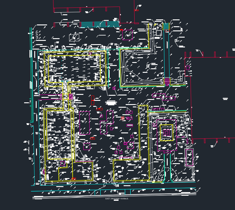
Gainesville City Hall Plaza
In order to assist with a re-design project, 3002 was requested to perform a topographic survey for the City of Gainesville of the City Hall Plaza, which includes a series of old reflection ponds and flintstone walls. As part of the scope, we also identified tripping hazards and other ADA concerns, during our field work.
Private Developer
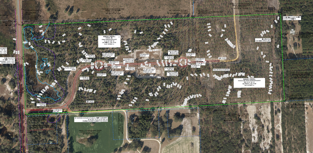
Pineridge Development
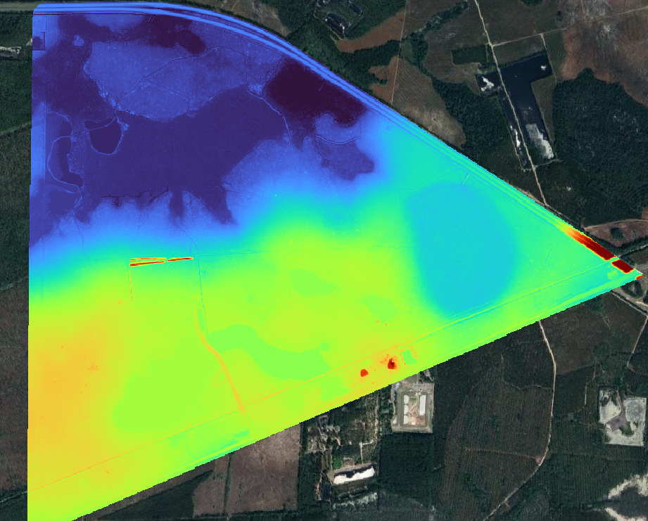
3002 was requested to assist in performing the boundary survey, topographic survey, wetland delineation and right-of-way survey to assist with this project located in Gilchrist County, Florida. Due to the size and timeframe requirements, 3002 acquired aerial imagery and LiDAR in order to assist with the topographic mapping of the site. We also collected inverts on many of the existing stormwater facilities, to assist the Engineer of the project with determining how the stormwater flows, based on existing conditions. 3002 also assisted with locating the wetland delineation flags.
Jacobs / Gainesville Regional Utilities
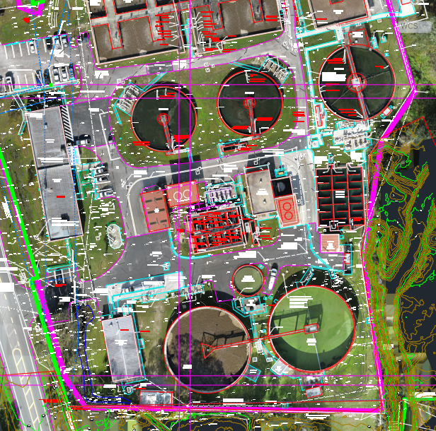
Main Street Water Reclamation Facility
3002 Geospatial has been assisting Jacobs with the Design / Build of the Gainesville Regional Utilities Water Reclamation Facility since 2010. We have performed topographic surveys, boundary / cadastral surveys, wetland delineation, tree surveys and have also flown both orthoimagery and LiDAR using both manned and unmanned platforms. Underground utility locates were performed by our subcontractor, Degrove Surveyors.
George F. Young, Inc.
N.E. Florida Private Development Client
In 2023, 3002 Geospatial was requested to assist in acquiring over 1,600 acres in aerial imagery and LiDAR to support a large development project in Northeastern Florida. 3002 acquired over 45 ground control points and delivered a 1-foot Digital Terrain Model, 1-foot contours and 3-inch GSD Orthoimagery.
George F. Young, Inc. / Black & Veech
Solar Farm LiDAR & Orthoimagery
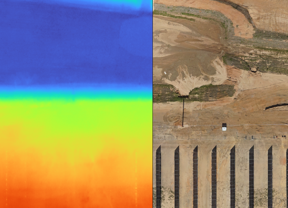
3002 Geospatial was requested to acquire rapid response aerial imagery of over 200 acres of solar farm located in Northwest Florida. 3002 mobilized in order to acquire ground control and fly the site utilizing We acquired 3-inch Ground Sample Distance orthoimagery and processed the Digital Terrain Model to a 6-inch DEM in addition to generating 1/2 foot contours.
Charles Bassett & Associates
Little Orange Lake
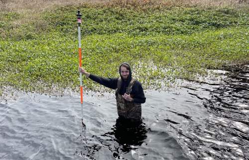
Charles Bassett & Associates requested 3002's assistance in helping establish the safe upland line and locating boundary monumentation for this project around the Southeastern rim of Little Orange Lake. This project involved establishing horizontal and vertical control, in addition to performing topographic and bathymetric surveys within the vicinity. 3002 also collaborated with the St. Johns River Water Management District, in order to utilize our data to test the 2018-2019 USGS Florida. Peninsular LiDAR dataset.
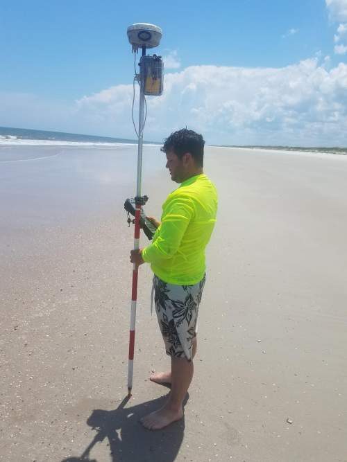
U.S. Army Corps of Engineers - Jacksonville District
Beach Erosion / Renourishment Topographic Surveys
3002 was tasked by longstanding partner, Degrove, to support them with their work with the U.S. Army Corps of Engineers in post-storm topographic surveying of beach shorelines.
3002 was tasked, as a time and materials contract, to perform the following scope:
A) Collect topographic beach profile data for the requested area.
B) perform profile surveys where the lines shall extend 150 feet landward (or to the limits of the beach, whichever is farther), from the established monument location or until a building, road, wall, protected vegetation, water, etc.
C) Profile lines shall extend seaward from the most landward offshore data point to the deepest wading depth safely obtainable.
D) Collect conventional spot elevations (X, Y, Z) on 10-foot ranges (land), all breaks in grade greater than 1 foot vertically, vegetation line, tops and toes of dunes, seawalls, or other manmade features along the profile line.
E) Locate any structures along each survey profile such as seawalls and dune walkovers.
City of Gainesville
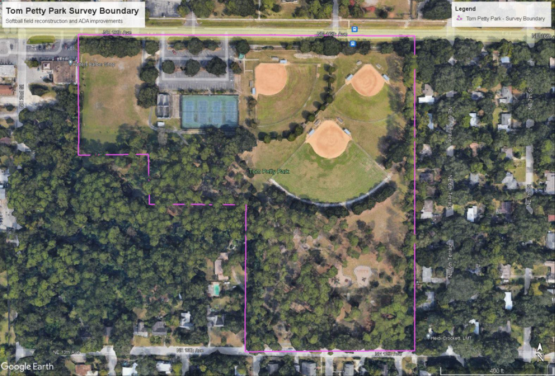
Tom Petty Park
The City of Gainesville identified the need to make various improvements to the City's Tom Petty Park, including improving upon ADA accessibility and improving upon the baseball field drainage. 3002 was tasked with performing a topographic survey along with locating boundary monumentation around the property.
The Scope included: a) a 50-foot grid spacing topo b) horizontal location of visible above ground utilities c) horizontal and vertical location of edges of asphalt d) critical spot elevations / significant breaks of grade e) location and elevations of stormwater facilities f) invert elevations and pipe sizes g) tree identification and locates and h) mapping contours.